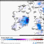
Forecast Issued – January 1st 2019
 TUESDAY JANUARY 1st 2019: Generally overcast with a few bright spells. Holding dry for much of the day, just the chance of a little mist when cloud thickens from time to time. A little cooler than of late with highest temperatures around 9c. Winds will be light northwesterly. Overnight will see overcast conditions gradually break up and under any prolonged clear spells, temperatures will dip quite low with perhaps some grass frost. Lows of 1c to 4c in calm conditions where some fog may develop locally.
WEDNESDAY JANUARY 2nd 2019: A similar day to New Year’s Day is forecast with patchy cloud, lingering fog and near calm conditions. Cooler again with highs reaching 7c or 8c at best. Cold overnight with cloud breaking up to allow fog and frost to form. Lows of -1c to 2c.
OUTLOOK: Continuing cool with patchy cloud and some sunny breaks up to and over the weekend. The nights will be cold with sharp frosts developing. The winds will be very light or calm for much of the time with High pressure centred just to the east over the Irish Sea. Saturday looks like being a little milder though as some southerly sourced air gets brought in with the flow for a time before cooler air returns from Sunday.
TECHNICAL DISCUSSION: High pressure is firmly the dominant factor in our weather for the next five to seven days ensuring dry and settled conditions which have set in since just before Christmas. However, as this high pressure has drifted north from France, the source of the airmass is now colder having originated over the continent, as opposed to the Atlantic which gave us milder and overcast conditions over the Christmas period.
High pressure looks set to dominate our weather over the next ten days or so, only a few computer models (American) suggest that the Atlantic will return bringing wind and rain – (though from a cold northwest blast which may see wintry showers). Other computer models (European) suggest that the high pressure will eventually become centred over Norway and encourage a very cold northeast flow to develop bringing quite cold conditions with snowfall possible.
It must be stressed though, at this time there is an event developing high up in the atmosphere across far northern latitudes that is called a “Sudden Stratospheric Warming”. This warming disrupts the usual flow of the winds across the northern latitudes and leads to unusual weather developing in unusual places as cold air plunges far south from the polar regions and warm air rallies north towards the polar regions. Where these airmasses migrate is at best guesswork and the computer models struggle to predict these movements of air.
With that in mind, it can be expected that there will be alot of uncertainty in medium to long range forecasts for the month of January as the effects of this “Sudden Stratospheric Warming” take hold. Last February a Sudden Stratospheric Warming took place which lead to the severe cold at the end of February into March. Another Sudden Stratospheric Warming took place back in 2013 which saw bitterly cold air reach eastern England where -18c overnight lows, but Ireland escaped with just cool frosty weather.


