
Forecast Issued – December 23rd 2017
NOTICE: The temperature sensor on the weather station in Durrow has become stuck on -67.8c and a replacement sensor will be fitted over the coming days… we apologise for any inconvenience caused.
SATURDAY 23rd DECEMBER: A foggy start to the day with morning lows around 8c, rising to 11c during the afternoon. A light breeze from the southwest will pick up clearing fog and it will become partly cloudy, with some sunshine. OVERNIGHT: Becoming overcast once more, though too breezy for any fog to form. Mild with lows of 6c to 9c. Some patchy mist or drizzle developing later in the night in light to moderate southwesterly breezes.
CHRISTMAS EVE: Overcast with patchy drizzle, dying out for a time in the late morning or early afternoon with some short sunny breaks possible. Remaining mild with highs of 11c, though it will feel cooler in a moderate southwest wind with gusting at times later as more general rain arrives from the northwest around nightfall. OVERNIGHT: Wet and windy with some heavy falls of rain expected later in the night before dawn. Mild with lows of 9c or 10c or so, however – colder air behind the rain will begin to dig in and temperatures will drop to around 6c at dawn.
WeatherWatch: Heavy rain later on Christmas Eve night is likely to cause spot flooding with between 12mm and 18mm of rainfall expected.
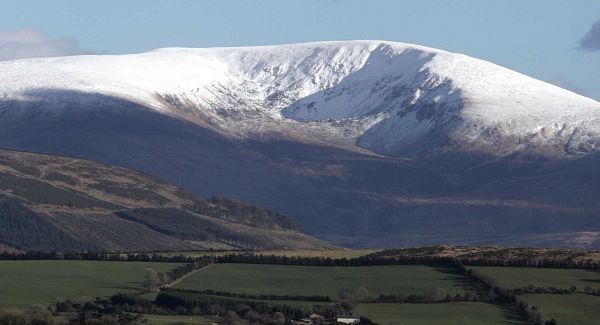
CHRISTMAS DAY: A wet and windy day, and feeling notably colder in a fresh to strong west wind, backing northwesterly and easing gradually in the late morning. Rain at may turn to sleet and possibly hill snow towards nightfall as temperatures drop throughout the day, from 6c in the morning to 2c around darkfall. A clearance from the west will slowly extend eastwards. OVERNIGHT: Any rain, sleet and snow will clear and skies will become generally clear too, though a wintry shower or two cannot be ruled out. A sharp frost will develop later in the night despite the moderate west wind with lows around 0c or -1c with ice on untreated pavements. Cloud will slowly increase from the south around dawn.
Weather Watch: Frost and ice developing later Christmas night, with slippery conditions on untreated pavements.
ST. STEPHEN’S DAY: Becoming cloudy once more with a high chance of rain, sleet and possibly snow extending from the southwest. There is however uncertainty about how far north this band of precipitation travels, (there is a possible repeat of the December 10th event, though not quite as intense). Please follow LaoisWeather on Facebook for updates as the situation develops. Cold with highs of 3c or 4c at best in light southwest winds, backing southeast then northeast later. OVERNIGHT: Any rain, sleet and snow will clear and under clearing skies a sharp to severe frost will develop in light to moderate northerly breezes. Lows of -3c to 0c.
Weather Watch: Frost and ice developing later St. Stephen’s night, with slippery conditions on untreated pavements.
WEDNESDAY 27th DECEMBER: A mostly clear and sunny day but cold in a light to moderate north to northwest breeze. Highs reaching 1c to 3c at best. OVERNIGHT: Turning very cold under clear skies with a severe frost as lows drop to between -5c and -2c in calm conditions.
OUTLOOK: Remaining unsettled and cold – further rain sleet and snow on Thursday, and no sign of mild weather returning this side of the New Year.


